| WAT JAN 2 (วัดจันทร์) |
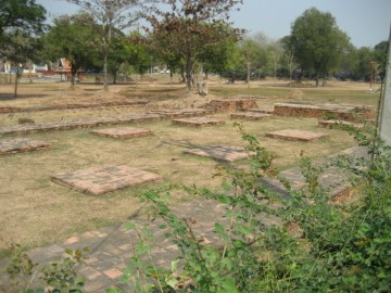
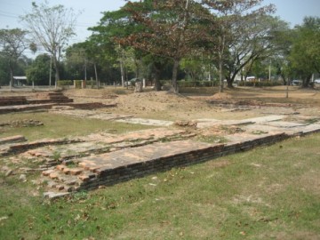
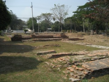
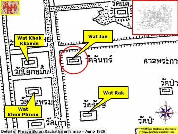
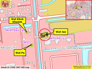
| Wat Jan or the Monastery of the Moon (1) is a restored ruin located on the city island in the Historical Park of Ayutthaya in Pratu Chai Sub-district. The temple was located on the corner of Talaeng Kaeng road and Khlong Chakrai Yai (the northern stretch - in the vicinity of the Grand Palace - is called Khlong Pak Tho). The monastery stood as thus near the Lam Hoei Bridge. On the opposite side of Khlong Chakrai Yai stood Wat Khok Khamin (defunct), while on its south was Wat Rak (defunct). The Phra Khan shrine stood in the east. In situ, only some brick foundations of the monastic structure remains. The site is mentioned on Phraya Boran Rachathanin's (PBR) map drafted in 1926, but features also on a map drafted in the mid 19th century. Wat Jan is positioned here identical as on PBR's map, but stands at the mouth of a canal running parallel with Talaeng Kaeng road. This canal turns after a few hundred meters into Khlong Pratu Tha Phra (aka Khlong Klaep). PBR does not mention this canal on his map; but aerial pictures still show some stretches of water south of the road leading to the old distillery. Wat Jan's historical background and period of construction are unknown. On the PBR map the temple is called "Monastery of the Moon" (วัดจันทร์), while on the mid-19th century map it is called "Monastery of the Gold Apple" (วัดจัน). (2) The site is located in geographical coordinates: 14° 21' 3.31" N, 100° 33' 22.75" E. Footnotes: (1) The denomination of Phraya Boran Rachathanin has here been followed. (2) Chan (Diospyros Packmanil - C. B. Clarke). A tall tree which bears yellow fruit. When ripe the shape of the fruit resembles the moon. Hence its name. The tree was not usually grown in the house compound, but curiously are to be found in monasteries and the royal palace compounds. If a person dares to plant such trees in his residential compound, misfortune will occur sooner or later to the owner. [1] References: [1] Some Siamese Superstitions about trees and plants - Phya Anuman Rajadhon - JSS Vol 49.1 - 1961 - page 59. |

| | | | | | | | |
| Text, maps & photographs by Tricky Vandenberg - April 2009 Updated May 2014 |
| | | | | | | |
| (View from the west) |
| (View from the east) |
| (View from the east) |

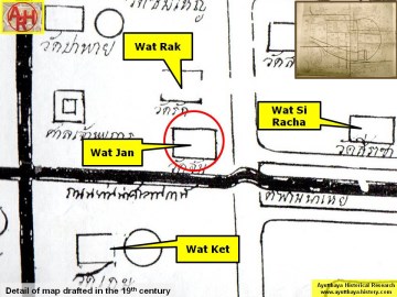
| (Detail of a 19th century map - Courtesy of the Sam Chao Phraya Museum - map is orientated S-N) |
| (Detail of Phraya Boran Rachathanin's map - Anno 1926) |
| (Detail of a 2007 Fine Arts Department GIS map - Courtesy of the Fine Arts Department - 3th Region) |