| WAT PA NAI (วัดป่าไน) |
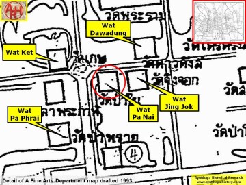
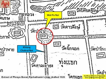
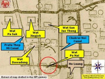
| Wat Pa Nai or the Monastery of the Inner Grove is a defunct monastery once located on the city island outside the Historical Park in Pratu Chai Sub-district. The temple stood on the present premises of the Chao Sam Phraya Museum, north of Rojana Rd. There are no visual traces of the monastery left at ground level. Its historical background and period of construction are not known. The site is indicated on Phraya Boran Rachathanin's (PBR) map drafted in 1926. PBR indicated this monastery in a marshy area formed by the confluence of Khlong Chakrai Noi and a connecting canal towards Khlong Pratu Thep Mi; south of the old Talaeng Kaeng street. A mid-19th century map shows Wat Pa Nai in the same area, taken into reference the Chakra Noi canal and the location of the main city tower (Ho Luang). Wat Pa Nai was located in Geo. Coord.: 14° 21' 6.66" N, 100° 33' 42.65" E. |

| | | | | | | | |
| | | | | | | |
| Text & maps by Tricky Vandenberg - January 2009 Updated February 2011, January 2015 |
| (Detail of Phraya Boran Rachathanin's map - Anno 1926) |
| (Detail of a 19th century map - map is orientated S-N) |
| (Detail of a 1993 Fine Arts Department map - Courtesy Khun Supot Prommanot, Director of the 3th Regional Office of Fine Arts) |