| WAT THA PHO (วัดถ้าโพ) |
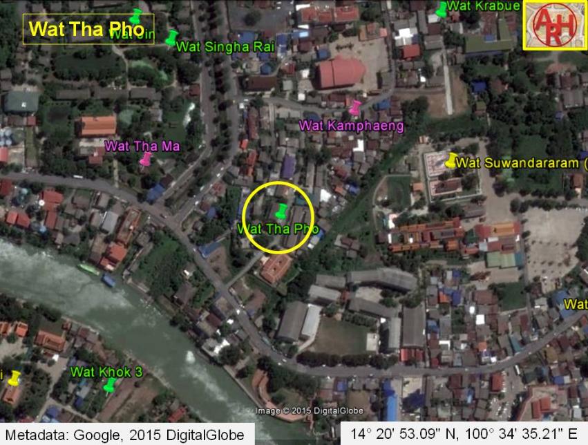
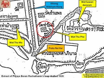
| Wat Tha Pho or the Monastery of the Landing of the Bodhi Tree was situated on the city island in the southeastern area at present Ho Ratana Chai Sub-district. Wat Tha Ma stood in the northwest, opposite Khlong Nai Kai presently called Khlong Makham Riang; Wat Suwandararam was on its northeastern side; Wat Kamphaeng was in the north and Phet Fortress in the south. The monastery was situated on the east bank of Khlong Nai Kai in close vicinity of Pratu Nai Kai, a water gate giving access to the water ring surrounding the city of Ayutthaya. Historical data about the monastery and its construction are not known. The monastery is indicated on a map drafted in the mid-19th century and on Phraya Boran Rachathanin's map of 1926. A ruined chedi is still remaining of this temple. Wat Tha Pho was located in geographical coordinates: 14° 20' 53.01" N, 100° 34' 33.07" E. |

| | | | | | | | |
| | | | | | | |
| Text & maps by Tricky Vandenberg - May 2010 Updated September 2018 |
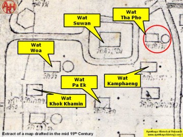
| (Detail of a 19th century map - Courtesy of the Sam Chao Phraya Museum - map is orientated S-N) |
| (Detail of a 19th century map - map is orientated S-N) |
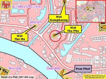
| (Detail of a 2007 Fine Arts Department GIS map - Courtesy of the Fine Arts Department - 3th Region) |