| WAT JAO TA (วัดเจ้าตา) |
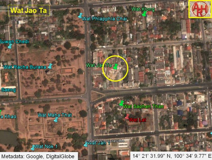
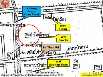
| Wat Jao Ta or Grandfather's Monastery was located on the city island outside the Historical Park of Ayutthaya in the north-eastern area in Pratu Chai sub-district. The monastery was situated on the east bank of the (now defunct) Khlong Pratu Khao Pluak. Wat Jao Ta stood more or less in the middle between Wat Racha Burana and Wat Phlapphla Chai on the opposite side of the canal. The Elephant Bridge was in the north and the Pa Than Bridge in the south. There are no traces anymore visible of the monastery above ground level. Historical data about the monastery and its construction are unknown. The site is indicated on Phraya Boran Rachathanin's map drafted in 1926 and features also on a mid-19th century map. Wat Jao Ta was situated in Geo Coord: 14° 21' 31.99" N, 100° 34' 9.77" E. |

| | | | | | | | |
| | | | | | | |
| Text & maps by Tricky Vandenberg - July 2010 Updated October 2010, April 2014 |
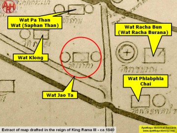
| (Detail of a 19th century map - Courtesy Sam Chao Phraya Museum) |
| (Detail of Phraya Boran Rachathanin's map - Anno 1926) |
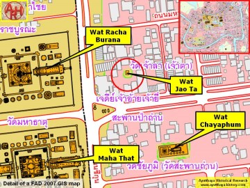
| (Detail of a 2007 Fine Arts Department GIS map - Courtesy of the Fine Arts Department - 3th Region) |