| WAT KHAO DIN 2 (วัดเขาดิน) |

| | | | | | | | |
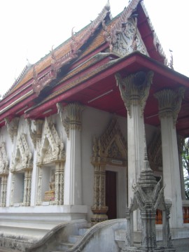
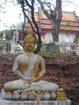
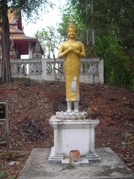
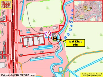
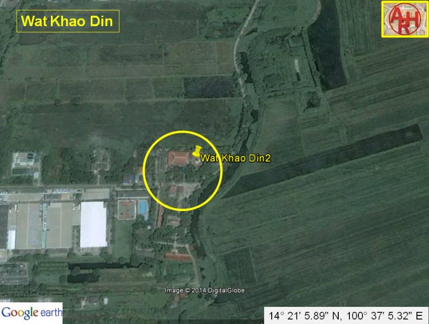
| This temple is located far away from the city island in the southeastern section of the city. Its closest landmark is the Asian Highway (#32), but this temple can also be located via a shortcut from Grand Street. Wat Khao Din is situated on the eastern side of the Asian Highway. The sparsely populated district where it is located is named after this monastery. Wat Khao Din marks the easternmost perimeter of this website’s research. Wat Khao Din is an active countryside temple that appears on the 1993 Fine Arts Department map. It was built on the site of an earlier monastery from the Ayutthaya period. It should not be confused with another temper under the same name near Wat Samana Kottharam. There is nothing visible above the ground at the second eastern monastery known as “Wat Khao Din”. In contrast, the Wat Kao Din by the Asian Highway has a thriving community of Buddhist monks. Therefore, it also has the usual structures needed to provide clerical services (monks’quarter, sermon hall, bell tower crematorium, etc.). The most outstanding feature of Wat Kao Din is its ordination hall. This building was constructed directly on top of the previous ubosot, creating a highly upraised mound. The basic foundation walls of the older structure are easy to view. Various layers are visible on every side of the new ordination hall. This includes portions of ancient staircases and some debris from old Buddha images. It was probably easier to build a new structure on the previous site than to restore the old one. The new ordination hall has high walls and elaborately defined porticos. The capitals of its pillars are crowned with swan-like Hansa, and its sema stones are sheltered inside of their individual pedestals. The new ordination hall reflects the style of the Bangkok period. There are also many Buddha images scattered outdoors in increments at the base of the ordination hall. These appear in various styles and poses. Some of the old staircases are adorned with Bangkok-period Naga serpents with mirrored-tiles. The chedi in situ are recent constructions. There is an old canal behind Wat Kao Din, which ultimately leads to Wat Krasang and Khlong Hantra (the old Pa Sak River). This canal probably connected rice farmers to the ancient city so that they could conduct trade. The canal has been covered due to the construction of the Asian highway. It has formed ponds at the monastery as a result. The history of this temple remains a mystery at this point. Its countryside location suggests that it was used by commoners who were mostly likely engaged in rice cultivation. The exact date of its establishment is unknown. |
| | | | | | | |
| Text & photographs by Ken May - September 2009 Maps by Tricky Vandenberg - January 2014 |
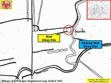
| (Detail of a 1993 Fine Arts Department map - Courtesy Khun Supot Prommanot, Director of the 3th Regional Office of Fine Arts) |
| (Detail of a 2007 Fine Arts Department GIS map - Courtesy of the Fine Arts Department - 3th Region) |
| (View of the ordination hall) |
| (Buddha image in front of an old monastic structure) |