| WAT KHOK MUANG (วัดโคกม่วง) |
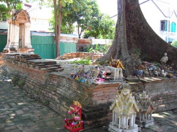
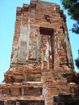
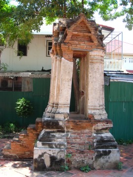
| Wat Khok Muang is located on the city island beside a small road east of Wat Maha That. The street is sometimes referred to as Bang-Ian Road on some maps, but locals never use this name. This deserted ruin is easy to find. The Boat Museum and Wat Maha That are the nearest landmarks. Wat Khok Muang is oriented in a east/west axis. In situ are three structures. To the east is a brick bell tower. It has five steps leading to the top and much of its stucco remains. In the middle of the monastery is a small sermon hall. A Bodhi tree is growing from the foundation where the altar would have been. There is a fragment of a sema stone beside the tree. The third structure is a mondop, which is perfectly aligned on the western side. This has a staircase and several redented corners. Wat Khok Muang has been renovated by the Fine Arts Department. There is to clear record of this monastery’s history. The architectural style suggests that it was constructed in the Late Ayutthaya period. Its location would have been reasonably close to Khlong Pratu Khao Pluak, but Wat Khok Muang was also accessible by footpath. De La Mare’s 1751 map features an unnamed pagoda that would have been in this approximate location. |

| | | | | | | | |
| Text & photographs by Ken May - August 2009 |
| | | | | | | |
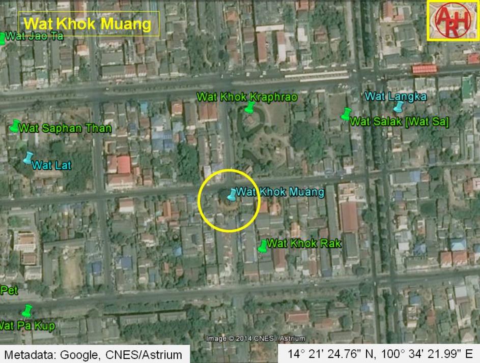
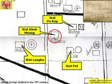
| Addendum Wat Khok Muang or the "Monastery of the Purple Mound" is indicated on a map drafted in the mid-19th century and on Phraya Boran Rachathanin's map of 1926. The ruins of the monastery are located in geographical coordinates: 14° 21' 24.76" N, 100° 34' 21.99" E. |
| Addendum & maps by Tricky Vandenberg - January 2011 Updated August 2014 |


| (View of a monastic hall of Wat Khok Muang) |
| (The stupa of Wat Khok Muang) |
| (View of the bell tower) |
| (Detail of a 19th century map - Courtesy of the Sam Chao Phraya Museum) This map is oriented an a South-North axis |
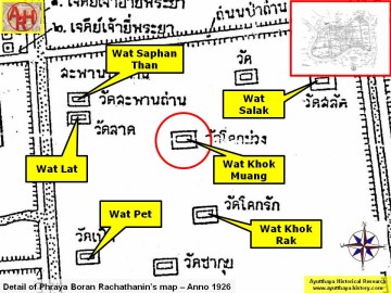
| (Detail of Phraya Boran Rachathanin's map - Anno 1926) |
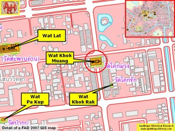
| (Detail of a 2007 Fine Arts Department GIS map - Courtesy of the Fine Arts Department - 3th Region) |