| WAT KLUEI (วัดกล้วย) |
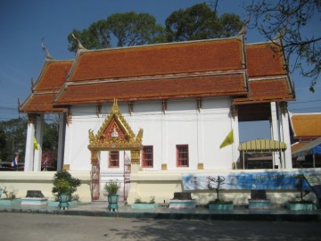
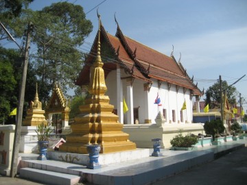
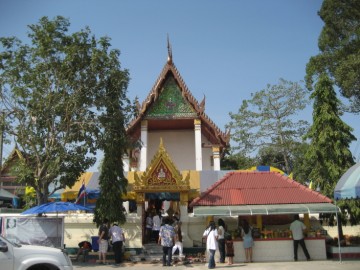
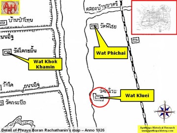
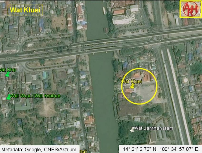
| Wat Kluei or the Banana Monastery is an active temple located off the city island in the eastern area in Kramang sub-district. The monastery is situated on the east bank of the Pa Sak River. The temple can be reached by taking the road (No 3477) parallel with the railway and south of the Pridi Phanomyong Bridge. North of the temple is Wat Phichai Songkhram and south lies Wat Ko Kaeo. In situ is a rather small monastic complex. The ordination hall (Th: ubosot) stands in the classic east-west alignment facing the Pa Sak river. The ubosot, built in the Late Ayutthaya style, has two elevated porches each with four columns supporting the two- tiered roof. Each porch has two entries. The southern and northern walls have three rectangular windows. The structure is surrounded by an inner wall, called kamphaeng kaeo (crystal wall), separating the monastic world from the secular world. The temple is mentioned in the Royal Chronicles of Ayutthaya as being the place where Luang Saraseni with his followers set up camp in December 1766. The Phraya of Tak was promoted to Phraya Kamphaeng Phet by the Siamese King Suriyamin (Ekathat) and appointed as a brigade commander of a boat army that he had to constitute at Wat Yai Chai Mongkhon in order to confront the Burmese in the open plains southeast of Ayutthaya. Phraya Kamphaeng Phet assigned the Phraya of Phetburi as his front guard, while Luang Saraseni’s troops were in support. The front guard consisting of five fighting boats got in contact with the enemy. The boats of the Phraya of Phetburi got completely encircled by the numerous boats of the Burmese. Phraya Kamphaeng Phet and Luang Saraseni moored their boats, watched but did not advance to reinforce the front guard. The troops of the Phraya of Phetburi were slain and the latter, after a heroic battle, was impaled by the Burmese. Phraya Kamphaeng Phet and Luang Saraseni fled the scene, did not return to the capital and set up stockades respectively near Wat Phichai and the adjacent Wat Kluei. Phraya Kamphaeng Phet, likely convinced that Ayutthaya would been soon lost to the Burmese, decided to seek his fortune in the south, while Luang Saraseni went his own way and fled elsewhere. [1] Its historical background and period of construction are unknown. Wat Kluei is indicated on Valentyn's map "Groote Siamse Rievier Me-Nam Of Te Moeder Der Wateren In haren loop met de vallende Spruyten Verbeeld" as Wat Kloy. [2] We find the monastery also on a map drafted in the mid-19th century and on Phraya Boran Rachathanin's map (1926). Wat Kluei is located in Geo Coord: 14° 21' 2.72" N, 100° 34' 57.07" E. References: [1] The Royal Chronicles of Ayutthaya - Richard D. Cushman - Page 512-514 / Source: Phan Canthanumat, British Museum, Reverend Phonnarat & Royal Autograph. [2] Valentyn, François - Oud en Nieuw Oost-Indiën (1626) - Deel 3 - Boek 6 - Beschryvinge van Siam en onsen Handel aldaar. |

| | | | | | | | |
| | | | | | | |
| Text, maps & photographs by Tricky Vandenberg - January 2010 Updated December 2014 |
| (Ordination Hall of Wat Kluei) |
| (The ordination hall seen from the east) |
| (The ordination hall seen from the west) |
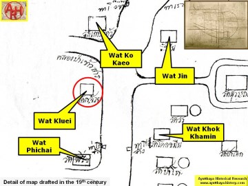
| (Detail of a 19th century map - map is orientated S-N) |
| (Detail of Phraya Boran Rachathanin's map - Anno 1926) |
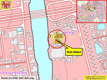
| (Detail of a 2007 Fine Arts Department GIS map - Courtesy of the Fine Arts Department - 3th Region) |
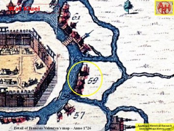
| (Detail of François Valentyn's map published in 1724) |