| WAT KUT (วัดกุด) |

| | | | | | | | |
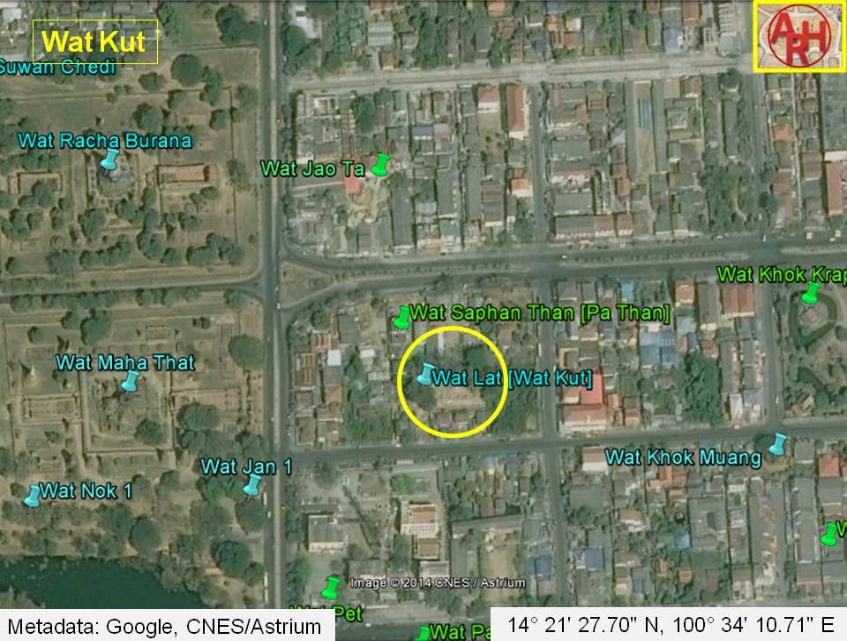
| Wat Kut or the Monastery of the Swamp was situated on Ayutthaya's city island outside the Historical Park in Pratu Chai sub-district, opposite Wat Maha That and the Pa Than Bridge. The denomination of this monastic structure could only be found on a mid-19th century map and its position corresponds more or less with the location where Phraya Boran Rachathanin indicates Wat Lat. Wat Pa Than also called Wat Saphan Than was situated north of Wat Kut opposite the road leading to Pratu Jao Jin and the Front City Canal, at present part of the Pa Sak River. Wat Kut is indicated on the mid-19th century map with a chedi at par with the chedi of the present ruin of Wat Lat situated in Geo Coord: 14° 21' 27.70" N, 100° 34' 10.71" E. This could lead to the conclusion that Wat Lat and Wat Kut were the same structures. |
| Text & maps by Tricky Vandenberg - January 2011 Updated December 2014 |
| | | | | | | |
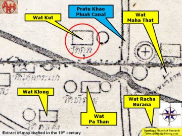
| (Detail of a 19th century map - map is orientated S-N) |