| WAT MO HON (วัดหมอโหร) |

| | | | | | | | |
| | | | | | | |
| Text & maps by Tricky Vandenberg - January 2014 |
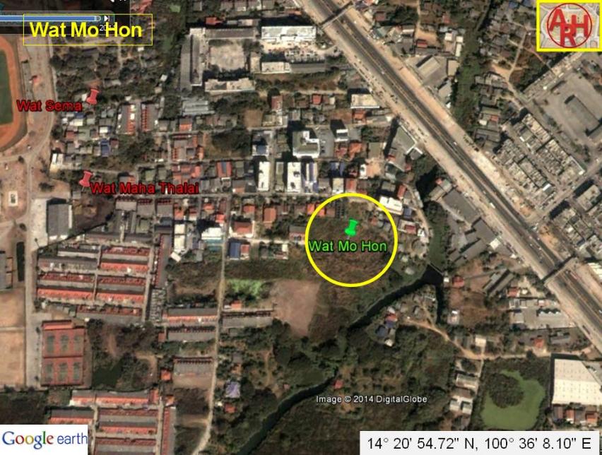
| Wat Mo Hon or the Monastery of the Astrologer was located off the city island in the southeastern area of Ayutthaya in Phai Ling Sub-district. The temple was part of a cluster of temples situated east of Wat Yai Chai Mongkhon. No traces of the temple are left on ground level, but it was situated on a small mound clearly visible on the Ayutthaya aerial flood map from November 2011. Wat Mo Hon was situated on the west bank of Khlong Pho (1), a canal splitting off from Khlong Khao Mao, east of Wat Krasang. The site is only mentioned on a Fine Arts Department (FAD) map drafted in 1993. To my knowledge no excavation has been performed by FAD on this site. Wat Mo Hon was situated in Geo Coord: 14° 20' 54.72" N, 100° 36' 8.10" E (approximately). Footnote: Not confirmed as yet, but Khlong Pho could have been connected to Ban Pho in Bang Pa-In district and exit into the Chao Phraya River opposite Ko Phra in a location called Ban Kedam by the Dutch or Krasen on 17-18th C maps. |
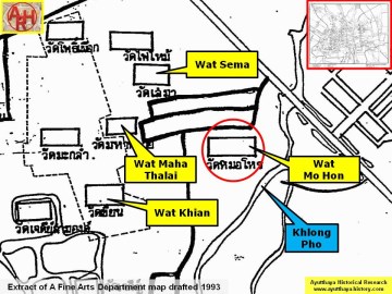
| (Detail of a 1993 Fine Arts Department map - Courtesy Khun Supot Prommanot, Director of the 3th Regional Office of Fine Arts) |