| WAT NANG KHA (วัดนางคา) |

| | | | | | | | |
| Text, maps & photographs by Tricky Vandenbergh - May 2009 Updated December 2010, January 2015 |
| | | | | | | |
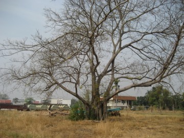
| (View of the site of defunct Wat Nang Kha) |
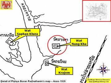
| (Detail of Phraya Boran Rachathanin's map - Anno 1926) |
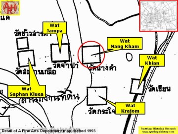
| (Detail of a 1993 Fine Arts Department map - Courtesy Khun Supot Prommanot, Director of the 3th Regional Office of Fine Arts) |
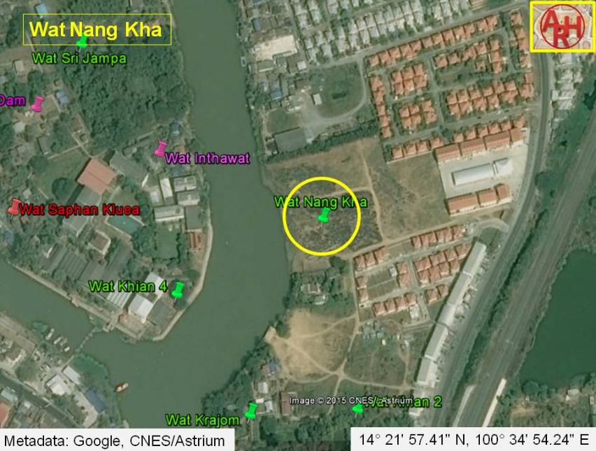
| Wat Nang Kha or the Monastery of the Woman named Kha was situated outside the city island of Ayutthaya in present Hua Ro Sub-district, just opposite Ko Loi and the Ship Building Institute. No visible traces are remaining at ground level. A large Ficus Religiosa or Bodhi tree in situ indicated the former premises of this temple. The area is presently a construction site. The temple is first mentioned on Phraya Boran Rachathanin’s map drafted in 1926. On a Fine Arts Department (1993) map this temple is called Wat Nang Kham. Its historical background and period of construction are unknown. Wat Nang Kha or Nang Kham must have been situated in approx. Geo Coord: 14° 21' 57.41" N, 100° 34' 54.24" E. |