| WAT PA RONG (วัดป่าโรง) |
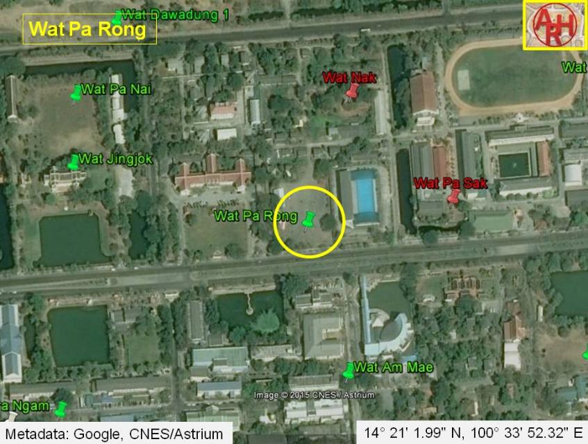
| Wat Pa Rong, which could be translated as the Monastery of the Mill Quarter, was located on the city island in the southern part of Ayutthaya in Pratu Chai Sub-district. The monastery was located on the west bank of Khlong Pratu Thep Mi, which connected the old Lopburi River (at present Khlong Mueang or City Canal) in the north with the Chao Phraya River in the south at Thep Mi water gate. Wat Saphan Nak lie on its north, while Wat Am Mae stood on its south along the same canal. There are no traces anymore visible of this monastery above ground level. Historical data about the monastery and its construction are unknown. The site is indicated on Phraya Boran Rachathanin's map drafted in 1926. The monastery has also been indicated as Wat Rom Khao or the Monastery of the White Umbrella. The site is not indicated on the Fine Arts Department (FAD) map of 1957, but reappears on the FAD maps of 1974, 1993 and the 2007 GIS map. The indication of Wat Rom Bang on the latter is likely a misinterpretation of the text on the older maps. Wat Pa Rong was located on the present premises of the Ayutthaya Witthayalai School in Geo Coord: 14° 21' 1.99" N, 100° 33' 52.32" E. |

| | | | | | | | |
| | | | | | | |
| Text & maps by Tricky Vandenberg - March 2010 Updated 30 November 2013, February 2015 |
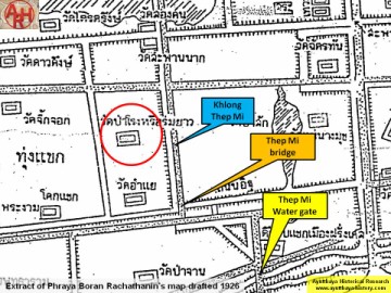
| (Detail of Phraya Boran Rachathanin's map - Anno 1926) |
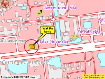
| (Detail of a 2007 Fine Arts Department GIS map - Courtesy of the Fine Arts Department - 3th Region) |