| WAT PHRAO (วัดพร้าว) |
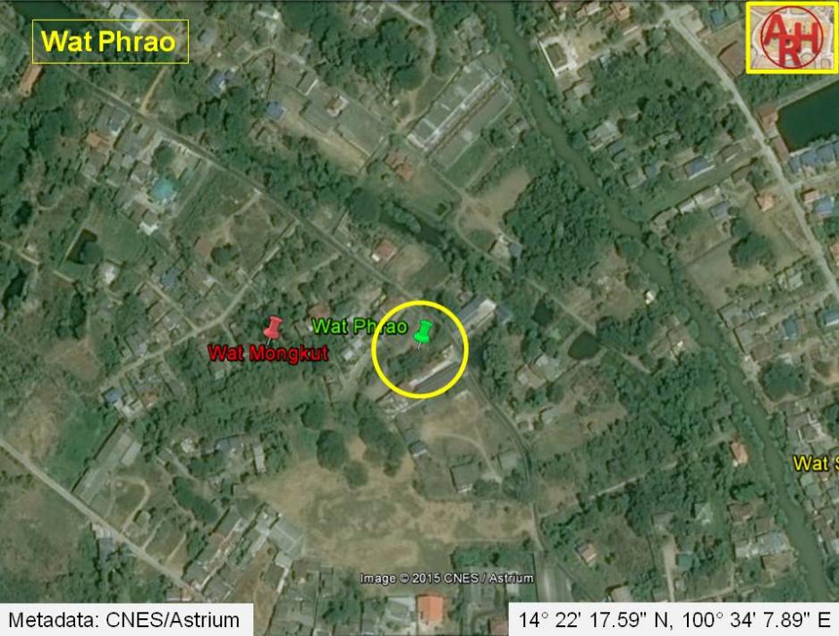
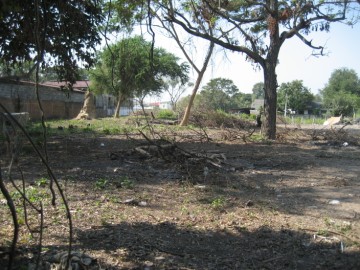
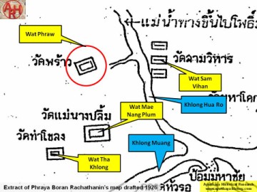
| Wat Phrao was located off the city island in the northern area in in Hua Ro Sub-district along a small canal giving access to Khlong Hua Ro (the old Lopburi River). The word "phrao" (พร้าว) is likely derived from "maphrao" (มะพร้าว) or coconut. The monastery stood in an area called before Thung Kaeo or "crystal field", bordered on the west and north by Khlong Sra Bua; on the east by Khlong Hua Ro opposite Wat Sam Wihan. This can be seen on Phraya Boran Rachathanin's map drafted in 1926, which indicates this temple. In the Ayutthayan Era a market was held near the temple. “Talat Wat Phrao” was one of the 30 land markets outside the city of Ayutthaya. In the manuscript "Testimony of the king from Wat Pradu Songtham", a document likely compiled in the Early Ratanakosin Period, is written that there was a land market at Wat Maphrao beside Ban Yuan Thale (1). At the village beside Wat Phrao, Indians and Thai made fragrant powder and oil, krajae scented water, krajae incense sticks, kradat incense sticks, and perfumes for sale. [1][2][3] The land of the former temple site was leveled shortly before a visit in December 2008. A boundary stone (bai sema) seemingly on its original pedestal and presumed to have belonged to the former temple, can still be seen on a private property in the immediate vicinity. The history of Wat Phrao and its construction date are unknown. The monastery is indicated on 1974, 1993 and 2007 Fine Arts Department (FAD) maps. The 2007 FAD map indicates Wat Phrao in Geo Coord: 14° 22' 21.04" N, 100° 34' 7.89" E. Following the contact I had with the villagers, the temple must have been situated in Geo Coord: 14° 22' 17.59" N, 100° 34' 7.89" E. Footnotes: (1) The village of the sea Vietnamese. References: [1] Geographical description of Ayutthaya: Documents from the palace - Dr Winai Pongsripian - Bangkok (2007). [2] Note on the Testimonies and the Description of Ayutthaya - Chris Baker - Journal of the Siam Society, Vol. 99, 2011 - page 77 (paragraph on KWPS). [3] Markets and Production in the City of Ayutthaya before 1767: Translation and Analysis of Part of the Description of Ayutthaya - Chris Baker - Journal of the Siam Society, Vol. 99, 2011- page 52-3. |

| | | | | | | | |
| | | | | | | |
| Text, maps & photographs by Tricky Vandenberg - April 2009 Reviewed September 2011, October 2013, March 2015 |
| (Former location of Wat Phrao) |
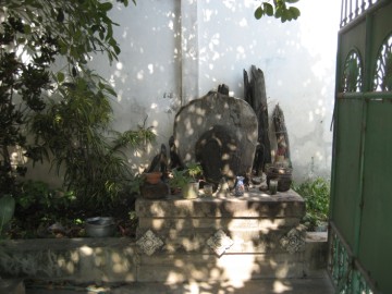
| (Presumed boundary stone of Wat Phrao) |
| (Detail of Phraya Boran Rachathanin's map - Anno 1926) |
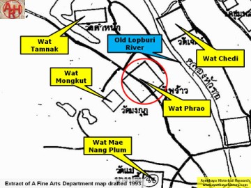
| (Detail of a 1993 Fine Arts Department map - Courtesy Khun Supot Prommanot, Director of the 3th Regional Office of Fine Arts) |
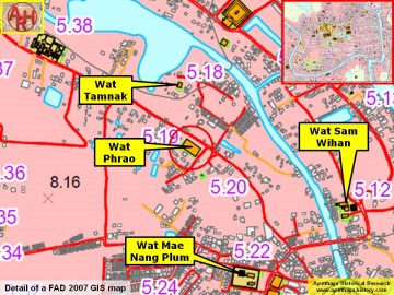
| (Detail of a 2007 Fine Arts Department GIS map - Courtesy of the Fine Arts Department - 3th Region) |