| WAT PHRAI (วัดพราย) |

| | | | | | | | |
| | | | | | | |
| Text by Tricky Vandenberg - May 2010 Updated December 2013, March 2015 |
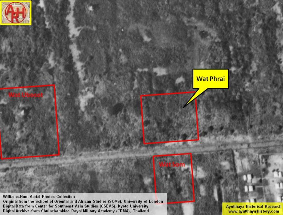
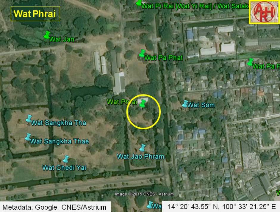
| Wat Phrai or the Monastery of the Spirit was situated on the city island in the Historical Park of Ayutthaya in Pratu Chai Sub-district. The temple was located on the west bank of Khlong Chakrai Yai (an extension of Khlong Tho). Wat Pa Phat (no traces anymore) stood in the north of Wat Phrai on the south bank of Khlong Klaep also called Khlong Tha Phra. Wat Som stood in its vicinity, opposite the canal bank. The ancient sites in its vicinity were cleared in the early 1970's during construction works of an expansion project of the (former) Ayutthaya Agriculture School (Withayalai Kasetrakam). There are no traces of foundations or brick work anymore at ground level and the temple is classified as defunct. [1] Historical data about the monastery and its construction is unknown. The site is found on Engelbert Kaempfer's sketch and map drafted in 1690 and also on Phraya Boran Rachathanin's map of 1926. The site was located in geographical coordinates: 14° 20' 43.55" N, 100° 33' 21.25" E. References: [1] Bangkok Post - 09 Dec 1972 - Work suspended on Ayutthaya sites. The article states that "machinery engaged on the Ayutthaya Agriculture School extensions ploughed up the ruins of at least five temples in the disputed area";. The work at the school was stopped after students had sent a petition to the NEC. The Director General of the Fine Arts Department at that time stated he was certain the damage had already been done. (Article courtesy of Ken May). |
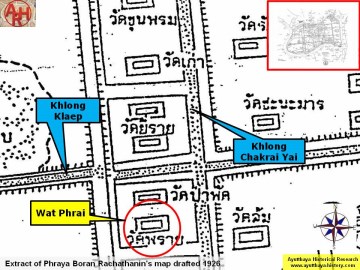
| (Detail of Phraya Boran Rachathanin's map - Anno 1926) |
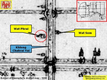
| (Detail of Engelbert Kaempfer's sketch map - Anno 1690) |