| WAT RANG 6 (วัดร้าง) |

| | | | | | | | |
| Text, photographs & maps by Tricky Vandenberg Updated March 2016 |
| | | | | | | |
| (Detail of a 2007 Fine Arts Department GIS map - Courtesy of the Fine Arts Department - 3th Region) |


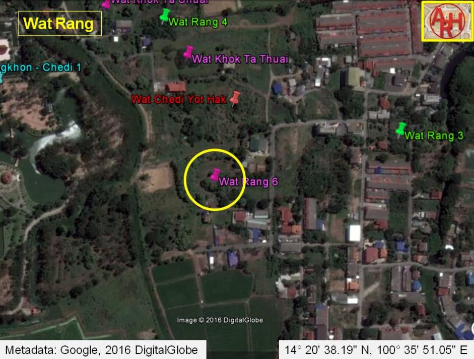
| Wat Rang (Lit: abandoned monastery) was situated off the city island in the eastern area of Ayutthaya in Phai Ling Sub-district. The monastery stood south of Wat Chedi Yot Hak. The only traces which are left is a brick mound with an open pit in the middle of the mound, where bricks had been collected for sale and searches were done to recuperate memorabilia of the former temple. Pieces of roof tiles were scattered over the area. Historical data about the monastery and its construction are unknown. The site is only mentioned on a 2007 Fine Arts Department map. The brick mound of Wat Rang is located in geographical coordinates: 14° 20' 38.19" N, 100° 35' 51.05" E. |