| WAT RO (วัดรอ) |
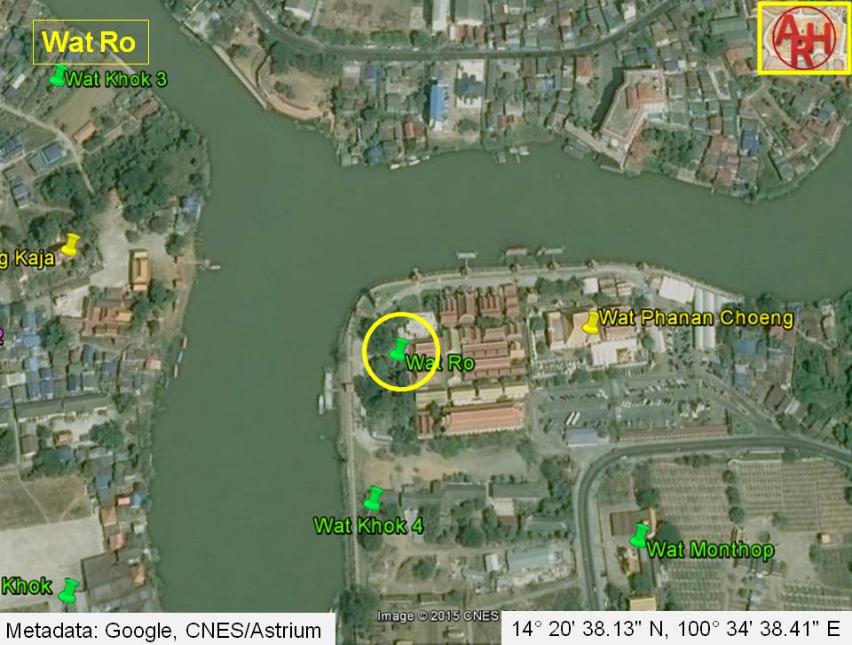
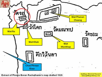
| Wat Ro is located off the main island in the southeast sector. It appears on several maps starting with Phraya Boran Rachathanin's 1926 map. This monastery was constructed beside Wat Phanan Choeng, but separated by a tiny canal. This site has since been annexed by Wat Phanan Choeng, which has greatly grown in popularity. There is no visible trace of Wat Ro above the ground. Presently on this site, there are a number of administrative buildings and houses used by Buddhist monks. There is little known about the history of this monastery. This area is ethnically Chinese, and it may have been used by this community as a shrine. |

| | | | | | | | |
| Text by Ken May - April 2009 |
| | | | | | | |
| Addendum Wat Ro is situated in Kramang Sub-district of Ayutthaya and situated on the "Dutch Island". The monastery stood north of Wat Khok and the Dutch Settlement. "Ro" means "wait" or "embankment". The temple could have received this name due to its vicinity near a boat landing; people near this temple waited the boat to cross to the city island. This landing was one of the six landings on the southern side of Ayutthaya, and connected the "Dutch Island" with Hua Sarapha. (See landings). The site was located in Geo Coord: 14° 20' 38.13" N, 100° 34' 38.41" E. |
| Addendum & maps by Tricky Vandenberg - January 2014 Updated April 2015 |
| (Detail of Phraya Boran Rachathanin's map - Anno 1926) |
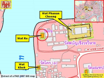
| (Detail of a 2007 Fine Arts Department GIS map - Courtesy of the Fine Arts Department - 3th Region) |