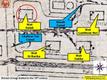
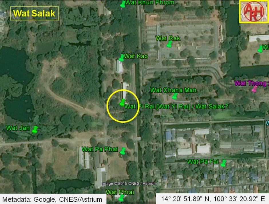
| Wat Salak or the Monastery of the Chisel was situated on the city island in the central area of Ayutthaya in Pratu Chai Sub-district. The site is only mentioned on a mid-19th century map. The temple stood on the west bank of Khlong Chakrai Yai and on the north bank of Khlong Klaep near the confluence of both canals. The monastery stood opposite Wat Pi Rai on the other canal bank (be aware the 19th C map positions Wat Pi Rai on the south bank of Khlong Klaep, while Phraya Boran Rachathanin indicates the temple on the north bank). The position of Wat Salak is nearly identical as Wat Pi Rai (Wat Yi Rai) depicted on Phraya Boran Rachathanin's 1926 map and the Fine Arts Department maps. The monastery in this location as thus could bear two names. The ancient site was cleared in the early 1970's during construction works of an expansion project of the (former) Ayutthaya Agriculture School (Withayalai Kasetrakam). There are no traces of foundations or brick work anymore at ground level and the temple is classified as disappeared. [1] In a document, the Geographical description of Ayutthaya, we find Wat Salak being indicated as Wat Kuti Salak. [2] The Nang Hong (Lady Swan) Bridge linked Wat Khwit Street (1) across Khlong Chakrai Yai with Wat Kuti Salak. Historical data about the monastery and its construction is unknown. Wat Salak should have been located in Geo. Coord.: 14° 20' 51.89" N, 100° 33' 20.92" E. Footnotes: (1) The street was likely named after the Khwit Monastery in its vicinity. Until today I found no indication of this monastery on any map. References: [1] Bangkok Post - 09 Dec 1972 - Work suspended on Ayutthaya sites. The article states that "machinery engaged on the Ayutthaya Agriculture School extensions ploughed up the ruins of at least five temples in the disputed area". The work at the school was stopped after students had sent a petition to the NEC. The Director General of the Fine Arts Department at that time stated he was certain the damage had already been done. [2] Phanna phumisathan Phra Nakhon Sri Ayutthaya: Ekasan jak Ho Luang - Geographical description of Ayutthaya: Documents from the palace - Dr Winai Pongsripian - Bangkok (2007) - page 35. |

| | | | | | | | |
| | | | | | | |
| Text & map by Tricky Vandenberg - August 2011 Updated March 2013, April 2015 |
| WAT SALAK 2 (วัดสลัก) |
| (Detail of a 19th century map - map is orientated S-N) |