| WAT KHANUN (วัดขนุน) |

| | | | | | | | |
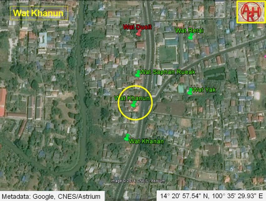
| Wat Khanun was a monastery situated off the city island in the eastern area of Ayutthaya in Phai Ling sub-district. The temple was located on the east bank of Khlong Dusit on the same north-south axis as Wat Dusit, Wat Saphan Rueak, and Wat Khanan. Wat Khanun was situated between Wat Saphan Ruek and Wat Khanan. The monastery's historical background and period of construction are unknown. The site is not indicated on a mid-19th century map, neither on Phraya Boran Rachathanin's map drafted in 1926 and features only on a FAD 1974 map [1]. The old texts recount that inhabitants from Ang Thong, Lopburi, Inburi, Phromburi, Singburi, Sanburi (1) and Suphanburi brought in paddy by boats and moored in front of Wat Samo, Wat Khanun and Wat Khanan, where they sold their merchandise. The local villagers in the vicinity of these three temples set up rice mills. The milled rice was sold in the city and to the local Chinese liquor distillers at Pak Khao San village. In the season when the junks set sail for China milled rice was sold as provisions for the junks. [2] The former location of Wat Khanun is situated in a build-up area and there are likely no traces visible of the monastery anymore above ground level. The site has not been excavated as yet. The monastery was approximately located in Geo Coord: 14° 20' 57.54" N, 100° 35' 29.93" E. Footnotes: (1) On Sanburi see footnote (1) on Wat Khanan. References: [1] FAD 1974 map - courtesy Dr. Surat Lertlum - Program Head of Computer Science Program - Chulachomklao Royal Military Academy. [2] Phanna phumisathan phrakhon si ayutthaya: ekkasan jak ho luang - Geographical description of Ayutthaya: Documents from the palace library - Dr. Vinai Pongsripian - Bangkok (2007) - page 89-90. |
| Text & maps by Tricky Vandenberg - June 2011 Updated December 2014 |
| | | | | | | |
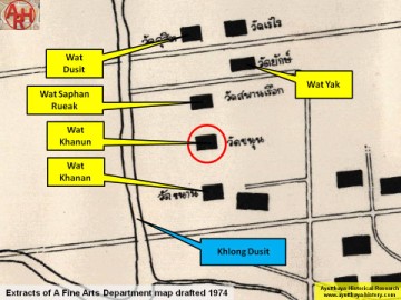
| (Detail of a 1974 Fine Arts Department map - Courtesy Dr. Surat Lertlum, Chulachomklao Royal Military Academy) |