| WAT KHOK SUEA (วัดโคกเสือ) |

| | | | | | | | |
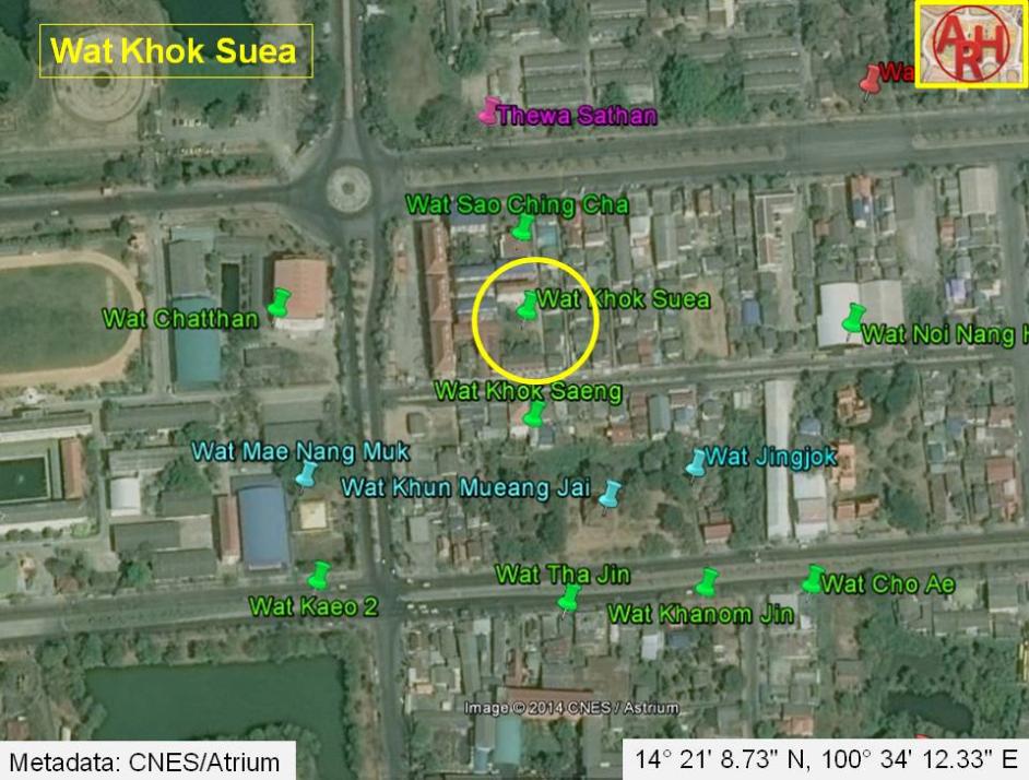
| Wat Khok Suea or the Monastery of the Mound of the Tiger is a defunct temple formerly located on Ayutthaya's city island outside the Historical Park in present Pratu Chai sub-district. Following a map of the 19th century the monastery was situated along the east bank of Khlong Pratu Jin, a presently defunct canal. Wat Sao Ching Cha (vanished) stood to its north and Wat Khok Saeng (vanished) to its south. Historical data about the monastery and its construction are unknown. The 19th century map indicates the existence of a chedi. The temple is not mentioned on Phraya Boran Rachathanin's map drafted in 1926. Making an assessment of all the monastic structures, in the zone demarcated by Chikun Road, Pa Thon Road, Pridi Banomyong Road and U-Thong Road is rather difficult, as the position and name of the structures vary on different maps. On a 19th century map, there are 15 structures counted, while on the 20th century PBR map there are 13 mentioned. There is inconsistency in the names and the positions. Even maps drafted by the Fine Arts Department, what I presume, based on excavations in the zone, shed no light on this matter. Positions of monastic structures can be asserted, but their ancient names will remain questioned forever. Wat Khok Suea was likely located in the vicinity of geographical coordinates: 14° 21' 8.73" N, 100° 34' 12.33" E. |
| Text & photograph by Tricky Vandenberg - November 2010 Updated October 2014 |
| | | | | | | |
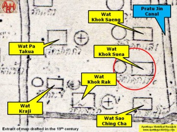
| (Detail of a 19th century map - map is orientated S-N) |