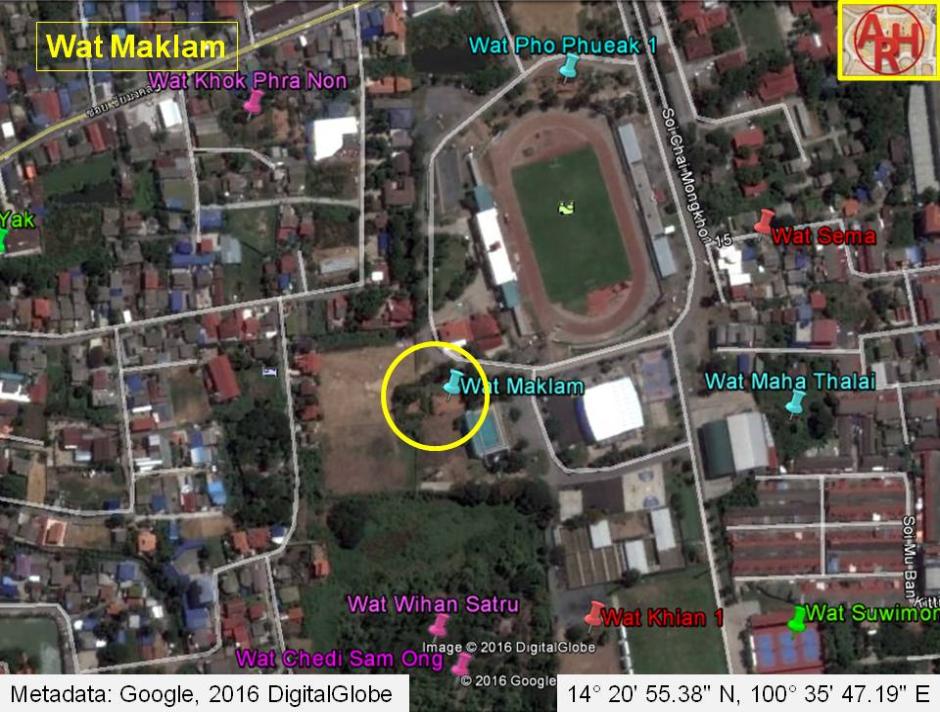
| WAT MAKLAM (วัดมะกลำ) |
| Wat Maklam is located in the Phai Ling area within a sports complex outside of the city island. The deserted ruin can be found on the outskirts next to a road that encircles the sports complex. It is difficult to see and covered in heavy vegetation most of the time. Unfortunately, a great amount of garbage has been dumped on this historic site. The architectural design consists of two structures. This monastery has been serious eroded, so it is difficult to make claims without further excavation. One eastern-oriented sermon hall contains traces of an altar with various stacks of disassembled Buddha images. A second building can be found behind this, which looks as if its floor has undergone some restoration. Both structures consist of only the basic foundation and neither of them have surviving walls. There is not a clear trace of a chedi, but there is a small mound that may contain the remains of one. There is no historic record for this monastery; however, the Fine Arts Department lists other temples within this sports complex as Middle Ayutthaya period constructions. There is evidence that earth walls once passed through this southeastern area but were knocked over to make room for rice fields. This could explain Wat Maklam's existence in such a remote location. In 1972, construction work was suspended on an extension of an agricultural school in this area after machinery dug up the remains of at least five temples. It is therefore interesting to note that virtually all of the buildings in this sports complex were constructed above the ground without further digging |

| | | | | | | | |
| Text by Ken May - May 2009 |
| | | | | | | |
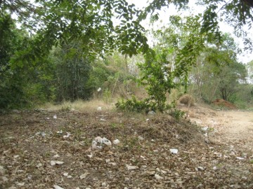
| (Site view of Wat Maklam) |
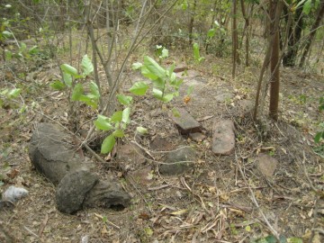
| (Brick work in situ) |
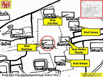
| (Detail of a 1993 Fine Arts Department map - Courtesy Khun Supot Prommanot, Director of the 3th Regional Office of Fine Arts) |
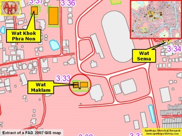
| (Detail of a 2007 Fine Arts Department GIS map - Courtesy of the Fine Arts Department - 3th Region) |
| Addendum Wat Maklam is indicated on a 1993 and 2007 Fine Arts Department map. The information board in situ mentions that the temple was set up in an east-west axis alignment. The principal chedi was in the form of a prang with a vihara in the east. In the south two satellite chedi were discovered. The vihara was built with bricks and mortar. It had a rectangular plan and faced east as usual. At the back of the structure was a pedestal for the principal Buddha image. The vihara was largely damaged over the decades and no evidence could be found of supporting pillars, neither remnants of the walls. Today only the foundations of these monastic structures remain (1). The Fine Arts Department dates the site back to the Early to Middle Ayutthaya period (14 - 17th century AD). The temple was restored in the late Ayutthaya period around the 18 - 19th century AD. Wat Maklam is situated on the horizontal axis Wat Khanan - Wat Maklam - Wat Maha Thalai - Wat Mo Hon. The monastery is east of Wat Khanan and north of Wat Wihan Satru. The site was restored after the large flooding of October-November 2011 Following an interview with Khun Chin near Wihan Satru on 16 March 2016, the site is incorrectly named Wat Maklam by the Fine Arts Department as the original name was Wat Pho Phueak. The ruins of Wat Maha Thalai are situated in geographical coordinates: 14° 20' 55.38" N, 100° 35' 47.19" E. Footnotes: (1) I interviewed quite a bit of elderly people in the four directions around Ayutthaya and I could come only to the conclusion that nearly all the ruins in or around of Ayutthaya, be it the outer and inner walls or the monastic structures themselves, had been dismantled in the late fifties, early sixties on a large scale. The bricks were locally used to help expand other temple sites, but mostly sold to contractors and shipped with trucks and boats to Bangkok. |
| Addendum, photographs & maps by Tricky Vandenberg Updated March 2016 |