| WAT PHOTHARAM (วัดโพธาราม) |
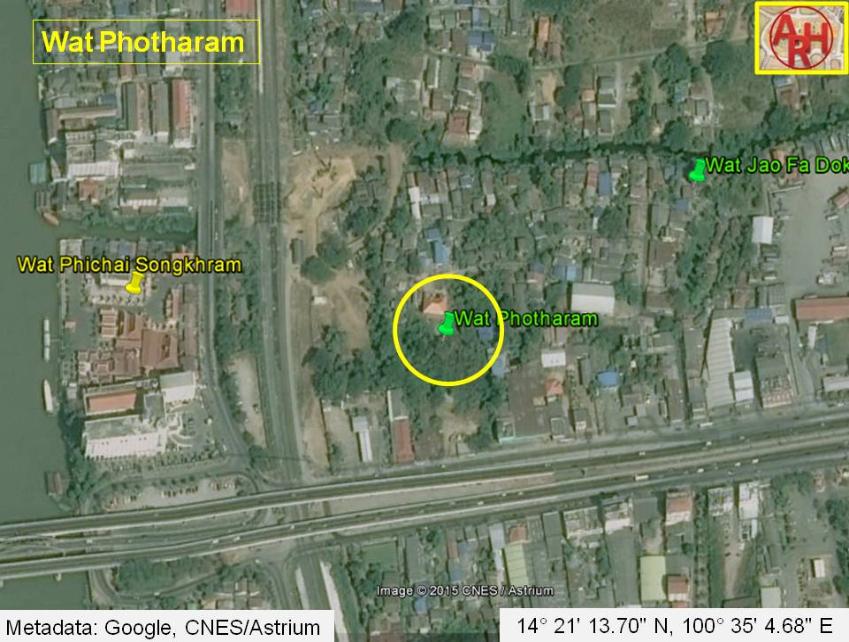
| Wat Photharam (1) or the Monastery of the Bodhi Tree was located off Ayutthaya's city island in the eastern area in Phai Ling Sub-district, east of the Pa Sak River today There are no visible traces of this monastery remaining at ground level. Its period of construction is unknown. This monastery is mentioned in the Royal Chronicles of Ayutthaya as being the site where the King of Prae and the left wing of the army of Hongsawadi, set up its stockade during the investment of Ayutthaya in 1549. The Mon armies were set up in a circle around the capital. In only one day they finished making a network of bridges of bamboo slats sewn with rattan across all the rivers, streams and canals so that the troops and horses could walk anywhere. [1] The King of Hongsawadi, having spoken, marched his army down to Ayutthaya on the following day, on Wednesday, the tenth day of the waning moon of the second month, 911, a year of the cock, first of the decade. The army of the Uparat, the vanguard, set up [BDEF: its stockade] in Phaniat Township. The stockade of the King of Præ, the left wing, was set up at Thung Wat Photharam Township to Kò Kæo Canal. The army of the King of Ava, the right wing, set up its stockade at [E: Thung] Wat Phutthaisawan Township to Takhian Canal. The army of the Phraya of Tòngu, the army of the Phraya of Cittòng and the army of the Phraya of Lakhoeng, the commissariat, set up their stockade [BDEF: from] [C: at] [D: Tha] Ka Ròng Monastery down to Chai Watthanaram Monastery. The army of the Phraya of Bassein and the army of the Phraya of Sariang, the vanguard of the main army, set up their stockade at Lumphli [BDEF: Township]. The main army set up [CF: its stockade] at Wat Pho Phüak Township, on the Pakkhu tax station rice fields. And the army of Prince Maha Thammaracha set up [E: its stockade] in Makham Yòng Township behind the royal stockade. The armies, which were set up in a circle [BDEF: around the Capital] [C: on that occasion], in only one day finished making a network of bridges of bamboo slats sewn with rattan across all the rivers, streams and canals so the troops and horses could walk anywhere. Wat Photharam stood probably in the vicinity of a royal pavilion (tamnak), which was located along Khlong Ban Bat. At the final days of Ayutthaya the pavilion was habited by Princess Rasami Sri Suriyawong Phong Kasatri, a daughter of King Borommakot. During excavations on the site a shattered stone tablet was found. The damaged engravings recounted that this monastery was called before Wat Phet and became ruined. The monastery was renovated and its name changed into wat Photharam by Princess Rasami. It is therefore deducted that this monastery should have been situated in the vicinity of the lodging of the princess. The lodgings of Princess Rasami became also a safe haven for ex-King Uthumphon (r. 1758) after the Burmese attack in 1760. [2] The monastery was located in Geo. Coord.: 14° 21' 13.70" N, 100° 35' 4.68" E. Footnotes: (1) The suffix "tharam" is used in Sanskrit for a comparative and superlative form (great - greater, string - stronger); hence Wat Pho - Wat Photharam. [3] References: [1] The Royal Chronicles of Ayutthaya - Richard D. Cushman (2006) - page 47 / Source: Phan Canthanumat, British Museum, Reverend Phonnarat, Phra Cakkraphatdiphong & Royal Autograph - The Hongsawadi Army Invests Ayutthaya. [2] Phraya Boran Rachathanin - Tamnan Krung Kao (1907) - pages 82-3. [3] A Sanskrit grammar; including both the classical language, and the older dialects, of Veda and Brahmana - William Dwight Whitney (1979) - Leipzig, Breitkopf and Härtel - page 159 #473. |

| | | | | | | | |
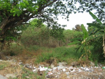
| (Former location of Wat Photharam) |
| Text, maps & photograph by Tricky Vandenberg - November 2009 Updated April 2013, March 2015 |
| | | | | | | |
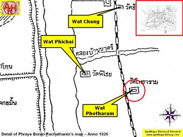
| (Detail of Phraya Boran Rachathanin's map - Anno 1926) |
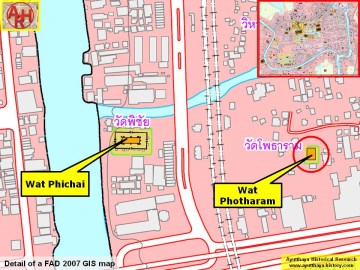
| (Detail of a 2007 Fine Arts Department GIS map - |