| WAT SALAK 1 (วัดสลัก) |
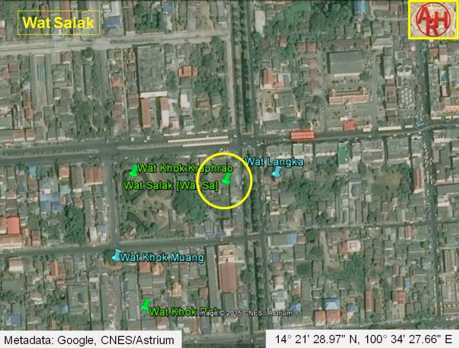
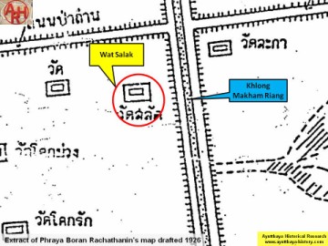
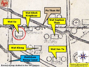
| Wat Salak or the Monastery of the Chisel was situated on Ayutthaya's city island in present Pratu Chai Sub-district, bordered by Khlong Makham Riang. The monastery stood opposite Wat Langka on the westbank of Khlong Makham Riang in former times called Khlong Nai Kai; a canal connecting Khlong Ho Ratana Chai in the north-east with the water ring in the south. The canal had its southern mouth at the Pratu Nai Kai, a water gate situated just west of Phet Fortress. Naresuan Road is situated just north of this defunct monastery. Historical data about the monastery and its construction are unknown. The site is indicated on Phraya Boran Rachathanin's map drafted in 1926. The monastery features also on a mid-19th century map but on the north side of the road leading from the Pa Than Bridge towards Pratu Joa Jin along the Front city canal. This road was called in earlier times Pa Than Rd, but was renamed Naresuan rd. The monastery features under the name Wat Sa on the map. Wat Salak was located in Geo. Coord.: 14° 21' 28.97" N, 100° 34' 27.66" E. |

| | | | | | | | |
| | | | | | | |
| Text & maps by Tricky Vandenberg - May 2010 Updated January 2011, April 2015 |
| (Detail of Phraya Boran Rachathanin's map - Anno 1926) |
| (Detail of a 19th century map - map is orientated S-N) |
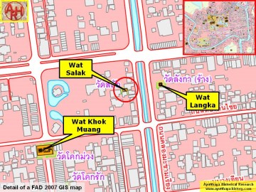
| (Detail of a 2007 Fine Arts Department GIS map - Courtesy of the Fine Arts Department - 3th Region) |