| WAT THONG PA MO (วัดทองปามอ) |

| | | | | | | | |
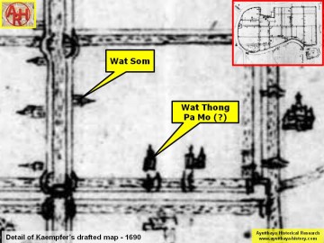
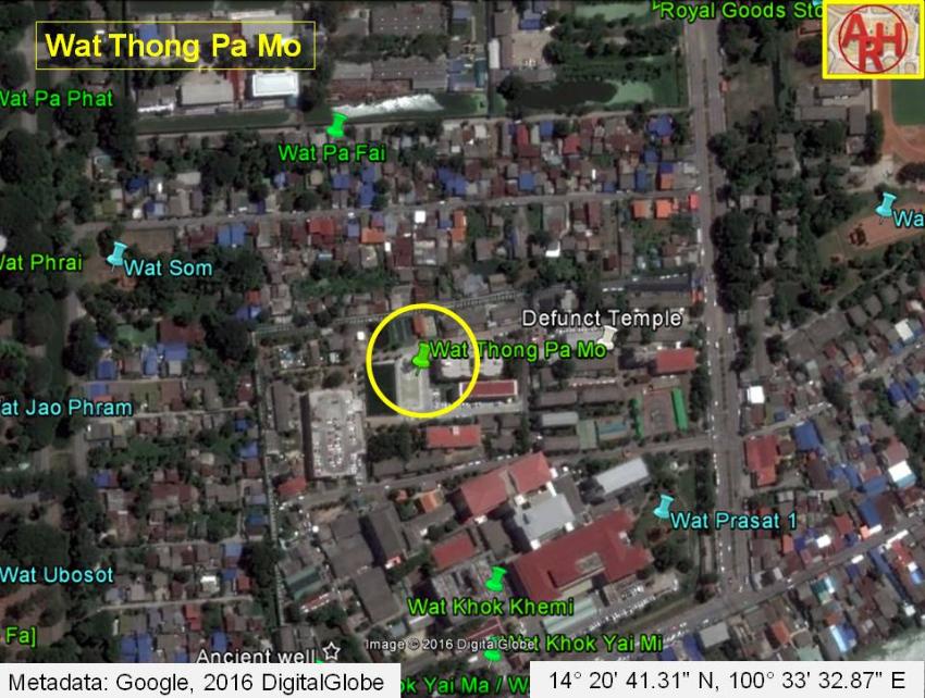
| Wat Thong Pa Mo or the Golden Monastery of Khlong Pa Mo was located on the city island in the Historical Park area in Pratu Chai Sub-district of Ayutthaya. The monastery was situated between Khlong Chakrai Yai and Khlong Chakrai Noi, and south of Khlong Pa Mo. It stood southeast of Wat Pa Fai. There are no traces anymore visible of the monastery above ground level. Historical data about the monastery and its construction are unknown. The site is indicated on Phraya Boran Rachathanin's [PBR] map drafted in 1926 and denominated Wat Thong Pak Mo (วัดทองปากหม้อ). ปากหม้อ means "Mouth of the Pot" and is as thus a bit a strange denomination for a temple. More likely it is miswritten on PBR's map, which should be correctly read as Pa Mo, referring to the Pa Mo Canal, which ran north of the temple. On the mid-19th century map we find no temple in this location, neither has the Fine Arts Department this site on its maps; but Engelbert Kaempfer has a temple in this location on his sketch drafted in 1690. It is to be noted that there are two temples named Wat Thong Pa Mo Noi and Wat Thong Pa Mo Yai indicated on the mid-19th century map, but their location does not fit with Wat Thong Pa Mo on PBR's map. If ever this site has existed, it must have been approximately located in geographical coordinates: 14° 20' 41.31" N, 100° 33' 32.87" E. |
| Text & maps by Tricky Vandenberg Updated March 2016 |
| | | | | | | |
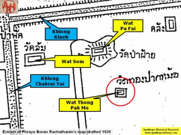
| (Detail of Phraya Boran Rachathanin's map - Anno 1926) |
| (Detail of Engelbert Kaempfer's sketch map - Anno 1690) |