
| | | | | | | |
| KHLONG CHANG (คลองช้าง) |
| Text & photographs by Tricky Vandenberg - April 2016 |
| | | | | | |
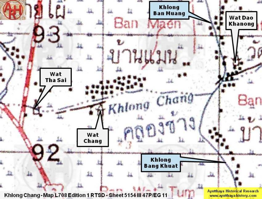
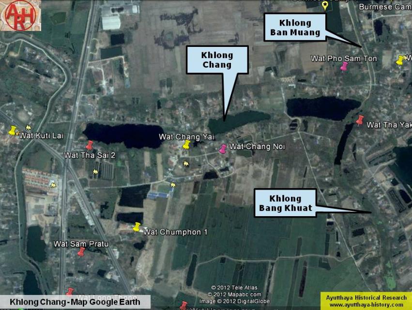
| Khlong Chang or the Canal of the Elephants is an old canal situated north of Ayutthaya on the border of Ayutthaya and Bang Pahan Districts. Khlong Chang was in fact the northern leg of the U-loop in the Lopburi River near an area called Thung Lum Phli before Khlong Bang Khuat was dug. The Lopburi River received a small part of the waters of Khlong Bang Phaeng, a track of the former Bang Kaeo River. A tributary split of at Ban Nonsi passed Wat Khok and separated again with a leg running into the loop of the Lopburi River near Wat Kuti Lai. [1] Thereupon Luang Aphai Phiphat, the Chinese, prostrated himself to address the King and volunteered to go forth to fight. He managed to organize a group of two thousand Chinese masters of the kai, advanced forth from the municipality, crossed the Canal of the Elephants and would have gone to erect a stockade. [2] The waterway between Wat Kuti Lai and Wat Dao Khanong was called Khlong Chang, likely because Wat Chang Yai and Wat Chang Noi, opposite Ban Maen, were situated along the track of this canal. Khlong Chang had its mouth near Wat Dao Khanong in the vicinity of the Bang Lang northern royal tax station. The old name of Wat Dao Khanong was Wat Pak Khlong or the Monastery at the Mouth of the Canal; a name which can be found back in the Royal Chronicles of Ayutthaya. When it was the third month [of the year] he accordingly advanced and halted at the Holy Residence of the Holy Crown Metropolis for about three days. Then he secretly sent a confidant down to extend an invitation to Reverend Phrom at the Monastery of the Mouth of Elephant Canal, saying, "His Highness Celestial Lord Aphaithot has already come and stayed at the Holy Residence of the Holy Crown Metropolis for three days. At this time he has issued a command for me to come and extend an invitation for Your Holy Personage and Overlord to go up to him." [3] Apparently the canal seems to have continued under an identical name running along the southern side of Wat Dao Khanong towards Wat Ton Satu and poured here into the new Lopburi River track. (2) [4] Opposite the mouth of the canal stood Wat Khung Nam Won (Monastery of the Whirlpool Bend), the community temple of Ban Nam Won. (1) Temples along Khlong Chang are Wat Kuti Lai, Wat Tha Sai (L), Wat Chang Yai (L), Wat Chang Noi (L), Wat Khae (L) and Wat Pho Rang (R). There are no traces of a community temple all along the north (left) bank of Khlong Chang at Ban Maen and this is rather exceptional. (3) Footnotes: (1) Kamnan Man indicated that Khlong Chang, cutting through Ban Lao, was bordered with wooden poles called Sao Talung (เสาทะลุง). These are the same poles which are surrounding the elephant kraal in Ayutthaya. The top-end of this poles are embellished with an ornamental knob (lotus-bud) and were used to tied up elephants. (2) Still today when boating in this bend of the Lopburi River near Wat Ton Satu you encounter whirlpools. (3) (L) and (R) are indicating respectively the left or right bank of the waterway. References: [1] Map L708 Edition 1 RTSD - Sheet 5154 III 47P /EG 11. Map based on aerial photography in 1954, annotated in 1955 and compiled in 1960. The map was not field checked. [2] The Royal Chronicles of Ayutthaya - Richard D. Cushman (2006) - page 481 / Source: Royal Autograph - Chinese Volunteers. [3] The Royal Chronicles of Ayutthaya - Richard D. Cushman (2006) - page 341 / Source: British Museum, Reverend Phonnarat & Royal Autograph - Revolt of Tham Thian. [4] Interview with retired Kamnan Man (หมาน) of Tambon Khayai in 2011. |
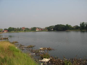
| (Khlong Chang east of Ban Maen) |
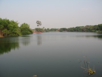
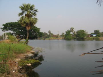
| (Khlong Chang near Ban Maen) |
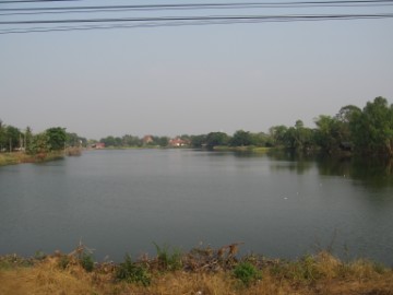
| (Khlong Chang west of Ban Maen and view of Wat Chang Yai) |
| (Khlong Chang from the west) |
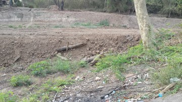
| (Old "Sao Talung" unearthed during maintenance of the canal stretch, east of Wat Dao Khanong early 2016) |