| WANON BRIDGE (สะพานวานร) |
| Text & photographs by Tricky Vandenberg - November 2009 Updated June 2019 |
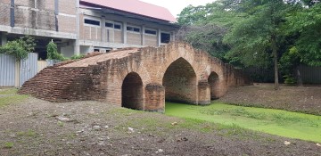
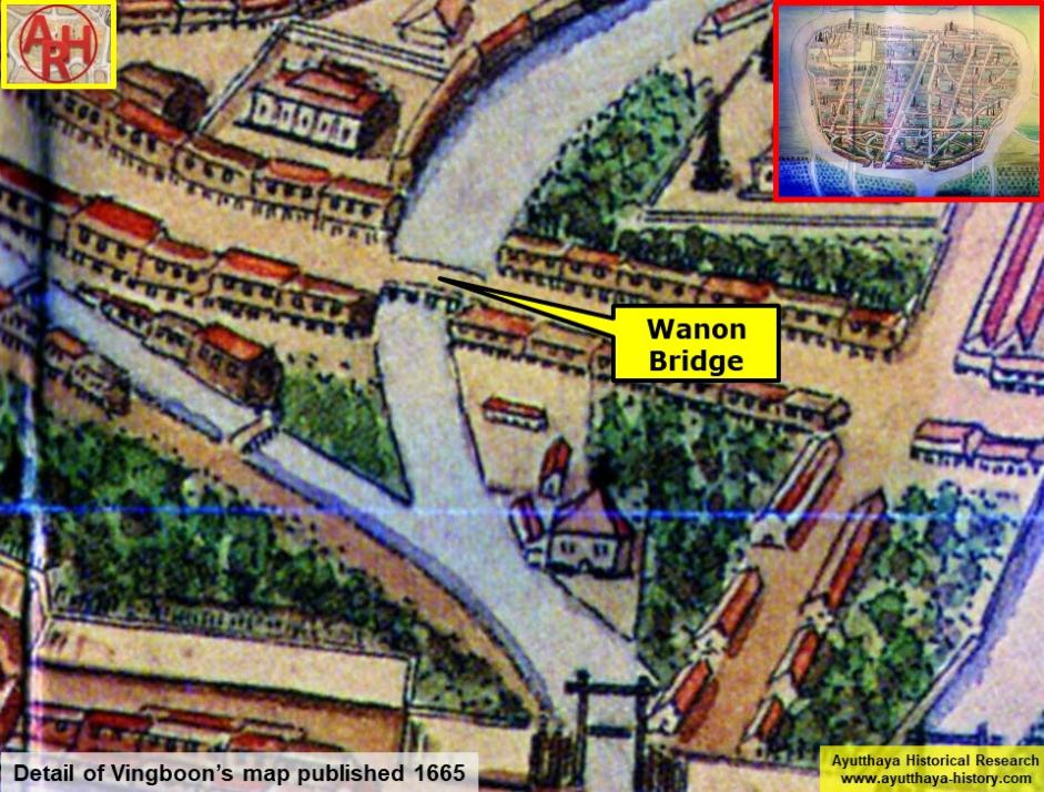
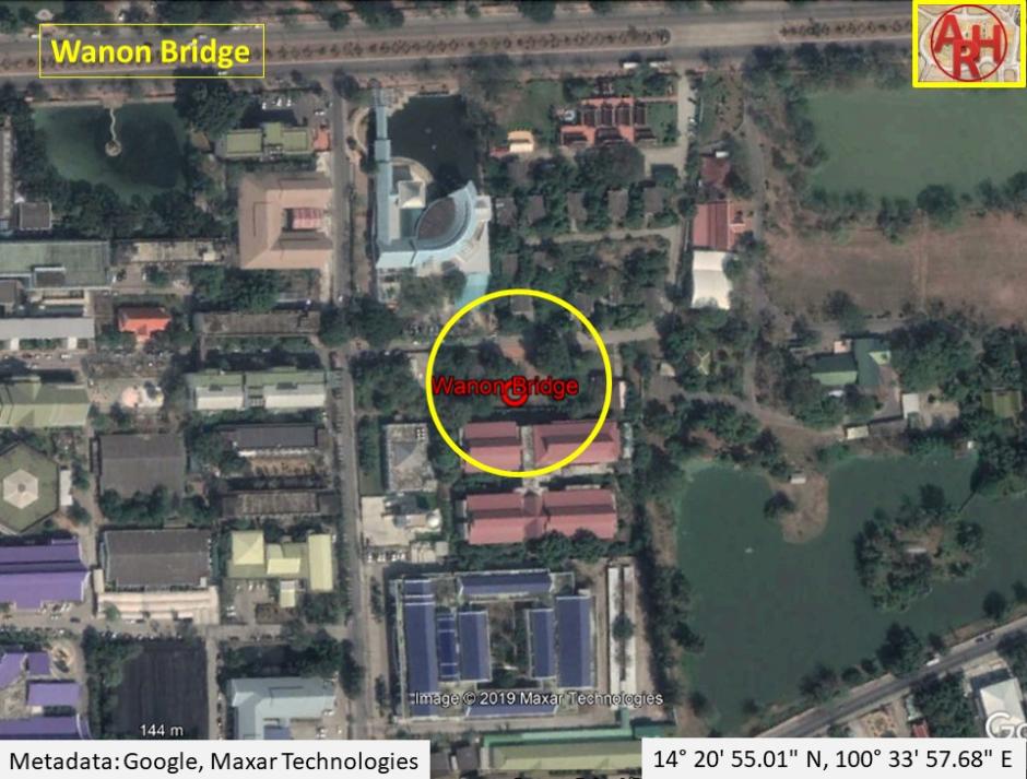
| Saphan Wanon or the Monkey Bridge and sometimes called Thep Mi Bridge is an old bridge located on the city island in the southern part of Ayutthaya in Pratu Chai Sub- district. The bridge is situated behind the Ayutthaya Historical Study Center. Wat Am Mae (vanished) stood before in its vicinity (south). The brick bridge was built over Khlong Pratu Thep Mi, which connected the old Lopburi River (later Khlong Mueang or City Canal) in the north with the Chao Phraya River in the south at Pratu Thep Mi. The northern part of the canal was called by the locals Lam Khu Pak Sra and cut through the Bueng Phra Ram area. Khlong Pratu Thep Mi was partly filled in after the fall of Ayutthaya in 1767 and is as thus at present inexistent. The foundations of the Wanon Bridge are still visible. The brick bridge in European style was probably identical to Saphan Pa Than. It was an arched construction with three sharply curved bows, the middle one higher and wider than the two others, making it possible for boats to pass underneath. The Wanon Bridge is mentioned in the old texts of the Kamhaikhan Khun Luang Ha Wat, the Kamhaikhan Khun Luang Wat Pradu Songtham and the Athibai phaen thi phra nakhon si ayutthaya from Phraya Boran Rachathanin wherein is written that there was "a brick bridge called Monkey Bridge, from Great Khaek Village Road to Net Village Road across the Thetsami Gate Canal …" [1][2] The Wanon Bridge connected west towards the White Clay Bridge (also called Sing Bridge) over Khlong Chakrai Noi and east towards the Talat Jin Bridge over Khlong Pratu Jin. Some remnants of the Wanon Bridge were still visible until the Year of the Great Flood (2011). In the years after, there was a large overhaul of all the monastic ruins in and around the City of Ayutthaya. The old structure was unfortunately not preserved and a completely new bridge was constructed in situ. The bridge is situated in geographical coordinates: 14° 20' 55.01" N, 100° 33' 57.68" E. References: [1] Phanna phumisathan phranakhon si ayutthaya: ekkasan jak ho luang [Geographical description of Ayutthaya: Documents from the palace]. Edited by Winai Pongsripian. Bangkok: Usakane, n. d. [2007]. [2] Athibai phaen thi phra nakhon si ayutthaya - Explanation of the map of the Capital of Ayutthaya with a ruling of Phraya Boran Rachathanin - Revised 2nd edition and Geography of the Ayutthaya Kingdom - Ton Chabab print office - Nonthaburi (2007). |
| | | | | | | |
| | | | | | | |

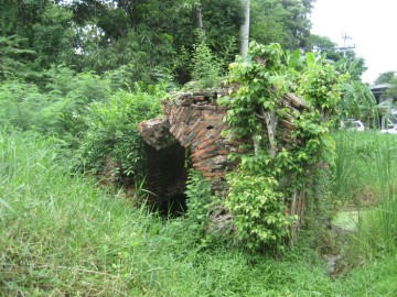
| (Wanon Bridge from the south - 2009) |
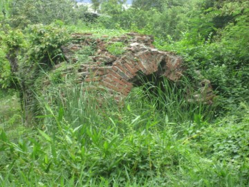
| (Wanon Bridge from the east - 2009) |
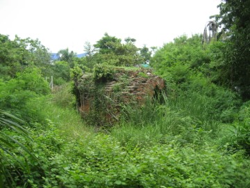
| (Wanon Bridge from the north - 2009) |
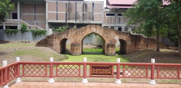
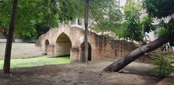
| (Restored Wanon Bridge - 2019) |
| (Restored Wanon Bridge - 2019) |
| (Restored Wanon Bridge - 2019) |
| (The Wanon Bridge on Vingboon's map which was published in 1665) |