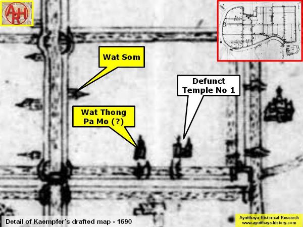
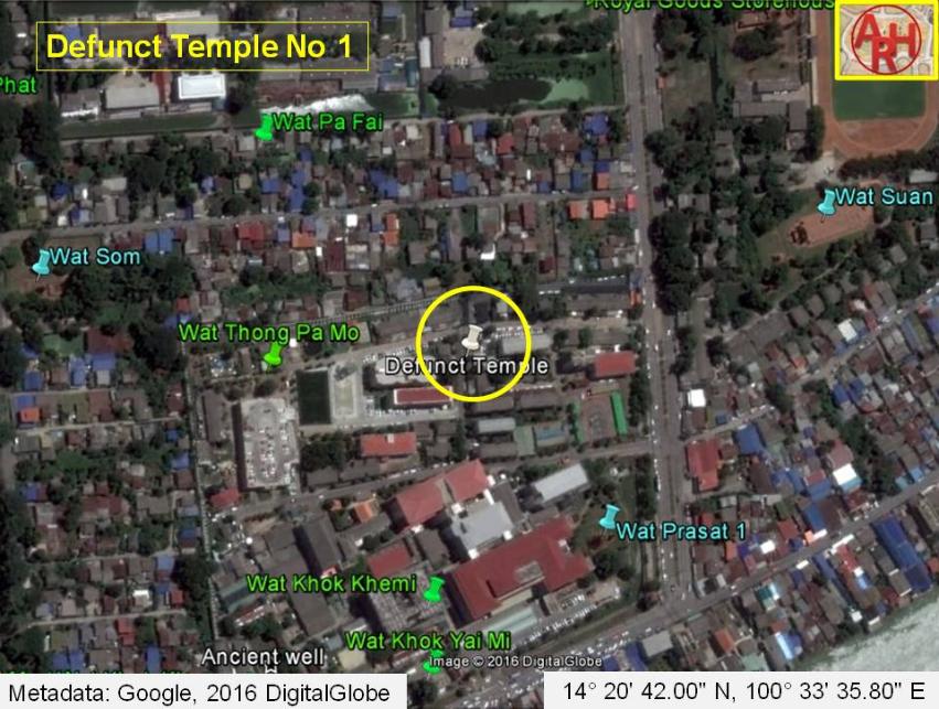
| DEFUNCT TEMPLE No 1 |

| | | | | | | | |
| Text & maps by Tricky Vandenberg - April 2016 |
| | | | | | | |
| Defunct temple without a denomination mentioned on Engelbert Kaempfer's sketch and draft map of 1690. The monastery is indicated with two chedi. The monastery stood south-west of Wat Suan Luang Khangkhao (restored ruin), south of Wat Pa Fai (defunct) and east of Wat Thong Pa Mo (defunct); and north in the extension of Victory Canal and Victory Gate (water gate). The temple was situated along a road coming from a wooden bridge over Khlong Chakrai Yai called Khun Lok Bridge, and connecting with Maha Rathaya Street. The road was lined on both sides by a canal and could be reached from the monastery by a bridge. The defunct monastery does not feature on any other maps. The site must have been approximately situated in geographical coordinates: 14° 20' 42.00" N, 100° 33' 35.80" E. |