
| | | | | | | | |
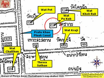
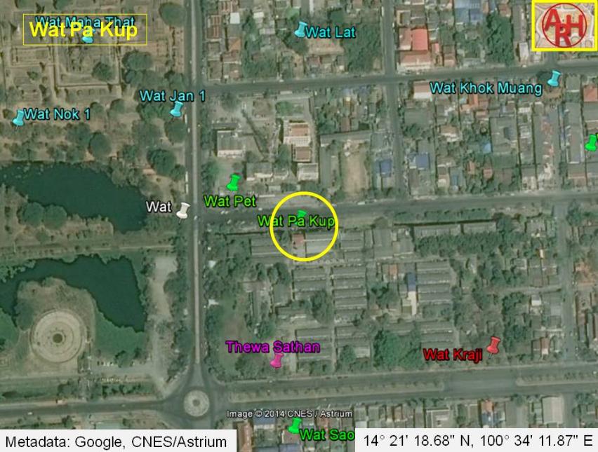
| Wat Pa Kup was located on the city island outside the Historical Park in Pratu Chai Sub-district. There are no traces remaining from this temple above ground level. Wat Pa Kup is positioned on a mid-19th century map, on the east side of Khlong Pratu Khao Pluak and west of Wat Pet. Wat Khok Rak stood in the north, while Wat Kraji was in the southeast. Wat Pa Kup is represented on the map with a redented chedi on a square base. Phraya Boran Rachathanin (PBR) situates Wat Pa Kup on his map drafted in 1926 more or less on the same spot, with Wat Pet in the north, Wat Khok Rak in the south and Wat Kraji in the southeast. The Fine Arts Department on a map drafted in 1993, abbreviates Wat Pa Kup to Wat Kup and indicates the monastery on the location where PBR positions Wat Pet, just north of Thewa Sathan, along Khlong Pratu Khao Pluak. It is obvious that there were different monastic structures in this area and their denomination remains unfortunately a bit of guess work. Historical data about Wat Pa Kup and its construction are not known. The site was located in Geo Coord: 14° 21' 18.68" N, 100° 34' 11.87" E. |
| Text & maps by Tricky Vandenberg - July 2010 Updated January 2011, December 2014 |
| | | | | | | |
| WAT PA KUP (วัดป่ากุบ) |
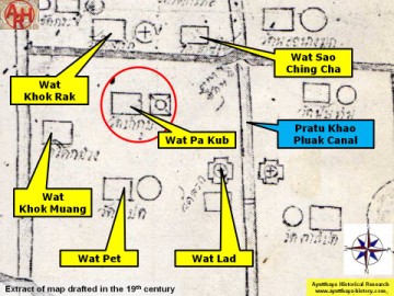
| (Detail of a 19th century map - map is orientated S-N) |
| (Detail of Phraya Boran Rachathanin's map - Anno 1926) |
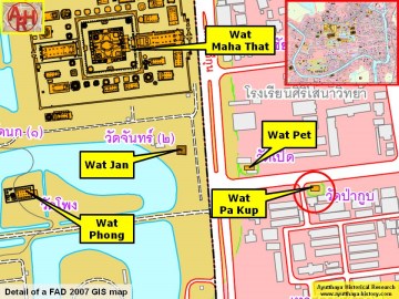
| (Detail of a 2007 Fine Arts Department GIS map - Courtesy of the Fine Arts Department - 3th Region) |