| WAT PET (วัดเป็ด) |
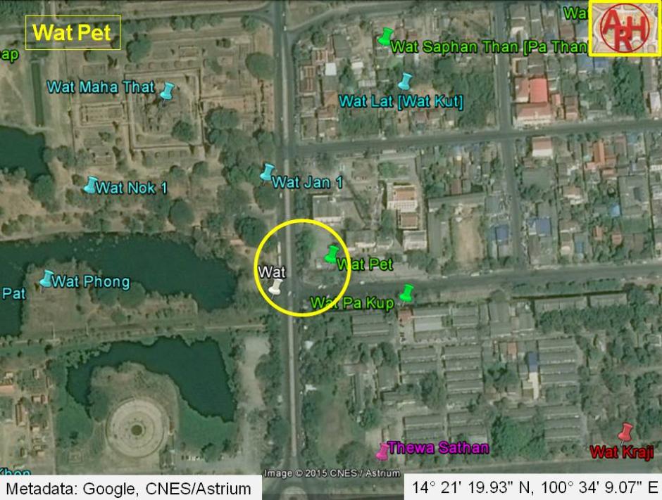
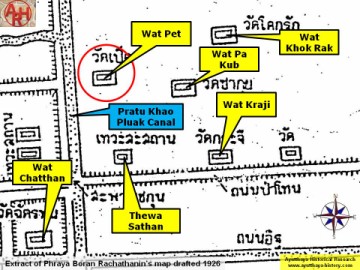
| Wat Pet or the Monastery of the Duck was situated on the city island on the edge of the Ayutthaya Historical Park in Pratu Chai Sub-district. At present there are still two ruined chedi visible on the west side of Chikun Road and as thus the temple must once have stood along the west bank of Khlong Pratu Khao Pluak, its southern extension called Khlong Pratu Jin. This canal has been completely filled up with the exception of a very small water stretch on the premises of Wat Racha Praditsathan. On a 19th century map, Wat Pet features more distant from the Pratu Khao Pluak canal; southeast of Wat Lat (1) and north of Wat Pa Kup. Phraya Boran Rachathanin puts Wat Khok Muang in this position. Wat Pet is on the 19th century map indicated with a chedi. Phraya Boran Rachathanin indicates on his 1926 map, Wat Pet on the east bank of Khlong Pratu Khao Pluak, north of Thewa Sathan (a Brahmin shrine part of Wat Sao Ching Cha) and west of Wat Pa Kup. On both, mid-19th and begin-20th century maps, the monastery is located on the east side of the former Khlong Pratu Khao Pluak. On a map of the Fine Arts Department drafted in 1993, curiously enough Wat Pet is indicated on the opposite side of the canal. It is obvious that there were different monastic structures in this area and their denomination and exact location remains unfortunately a bit of guess work. Historical data about Wat Pet and its construction are not known (2). Wat Pet was located in Geo. Coord.: 14° 21' 19.93" N, 100° 34' 9.07" E. Footnotes: (1) On the 19th century map, a bridge over Khlong Pratu Khao Pluak is visible near Wat Lat - see the webpage The bridges along Khlong Pratu Khao Pluak - Pratu Jin. (2) We have categorized this monastery as a restored ruin, because still some brickwork exists and it has been restored by the Fine Arts Department. |

| | | | | | | |
| Text, maps & photographs by Tricky Vandenberg - October 2009 Updated January 2011, February 2015 |
| | | | | | | |
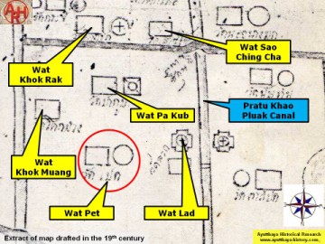
| (Detail of a 19th century map - map is orientated S-N) |
| (Detail of Phraya Boran Rachathanin's map - Anno 1926) |
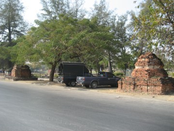
| (View from the East) |
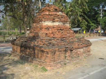
| (Northern octogonal stupa on square base) |
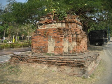
| (Southern 12-redented stupa on a square base) |
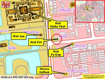
| (Detail of a 2007 Fine Arts Department GIS map - Courtesy of the Fine Arts Department - 3th Region) |