| WAT KAMPHAENG 1 (วัดกำแพง) |
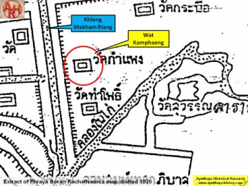
| Wat Kamphaeng or the Monastery of the Wall is situated in the east of Ayutthaya on the city island in Ho Ratana Chai district; south of Rojana Road and east of Khlong Makham Riang. Wat Suwan Dararam was on its south-eastern side, while Wat Tha Pho stood in the south. The foundations of the monastery are buried under the present Buddhist shrine set in place. Its historical background and period of construction are unknown. Wat Kamphaeng is indicated on a map drafted in the mid-19th century and on Phraya Boran Rachathanin's map of 1926. The site is located in Geo Coord: 14° 20' 57.22" N, 100° 34' 38.29" E. |

| | | | | | | | |

| Text, maps & photographs by Tricky Vandenberg - April 2009 Updated May 2014 |
| | | | | | | |
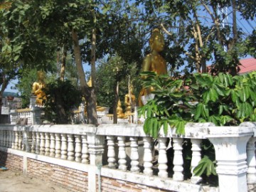
| (View from the East) |
| (View from the South) |

| (North side) |
| (Detail of Phraya Boran Rachathanin's map - Anno 1926) |

| (Detail of a 19th century map - map is orientated S-N) |

| (Detail of a 2007 Fine Arts Department GIS map - Courtesy of the Fine Arts Department - 3th Region) |
