| WAT SAMO (วัดสมอ) |
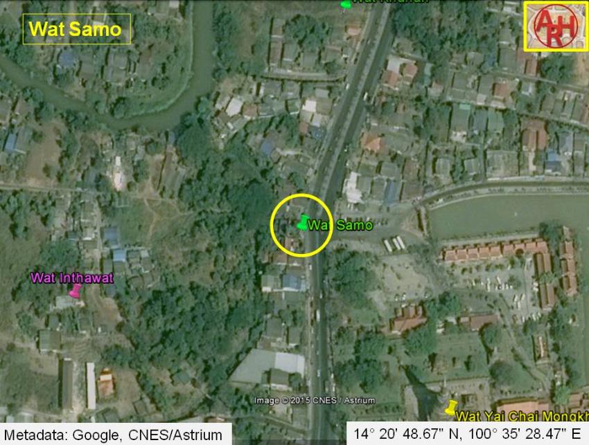
| Wat Samo or the Monastery of the Anchor was a monastery situated off the city island in the eastern area of Ayutthaya in Suan Phlu Sub-district. The temple was located on the east bank of a canal running south (1) along the present Wat Yai Chai Mongkhon premises and which was originating at the confluence Khlong Dusit and Khlong Khao San. This canal - Khlong Khanom Tan - was likely the western moat around Wat Yai. Wat Samo stood as thus in the northwestern corner of what was possibly in earlier times an old Khmer sanctuary. The site is not indicated on a mid-19th century map, neither on Phraya Boran Rachathanin's map drafted in 1926 and features only on a FAD 1974 map [1] and FAD 1993 map [2]. The monastery's historical background and period of construction are unknown. The old texts recount that inhabitants from Ang Thong, Lopburi, Inburi, Phromburi, Singburi, Sanburi (1) and Suphanburi brought in paddy by boats and moored in front of Wat Samo, Wat Khanun and Wat Khanan, where they sold their merchandise. The local villagers in the vicinity of these three temples set up rice mills. The milled rice was sold in the city and to the local Chinese liquor distillers at Pak Khao San village. In the season when the junks set sail for China milled rice was sold as provisions for the junks. [3] Wat Samo is now buried under Road 3477 passing Wat Yai more or less in front of its parking lot. A commemoration pavilion for Wat Samo has been built on the west side of the road. A villager living in the vicinity of the pavilion stated that before Rd 3477 leading to Bang Pa-In was built, a canal existed in front of Wat Samo; called Khlong Wat Samo. (1) If this was indeed the case than this canal could have been the western moat of Wat Yai and leading to Wat Bot Daeng. Footnotes: (1) Interview on 1 February 2012 adjacent sala Wat Samo. References: [1] FAD 1974 map - courtesy Dr. Surat Lertlum - Program Head of Computer Science Program - Chulochomklao Royal Military Academy. [2] FAD 1993 map - courtesy Khun Supot Prommanot - Director of the 3th Regional Office of Fine Arts. [3] Phanna phumisathan Phra Nakhon Sri Ayutthaya: Ekasan jak Ho Luang - Geographical description of Ayutthaya: Documents from the palace - Dr Vinai Pongsripian - Bangkok (2007) - page 89-90. |

| | | | | | | | |
| Text, photographs & map by Tricky Vandenberg - June 2011. Updated February 2012, April 2015 |
| | | | | | | |
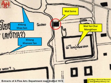
| (Detail of a 1974 Fine Arts Department map - Courtesy Dr. Surat Lertlum, Chulachomklao Royal Military Academy) |
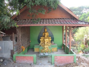
| (Commemoration pavilion Wat Samo) |
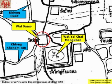
| (Detail of a 1993 Fine Arts Department map - Courtesy Khun Supot Prommanot, Director of the 3th Regional Office of Fine Arts) |
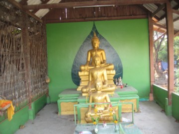
| (Commemoration pavilion Wat Samo) |